Have you ever wondered about the strange route followed by the plane when looking on the screens during the journey? This is especially the case for long flights like flying between Europe and the USA:
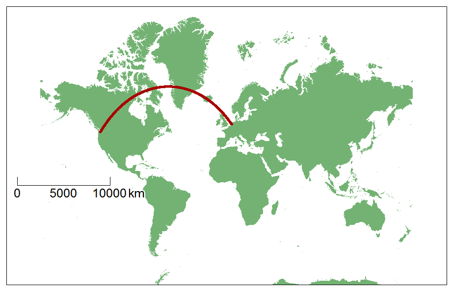
As you can see, for a flight from Amsterdam Schiphol to Seattle-Tacoma, the plane takes first a route full to the North and then curves southwards to the destination. Why not flying a straight line from origin to destination airport like depicted in the following map?

Well, the weird thing here comes simply from the map projection used in the previous examples. A map, which is flat, is the result of the projection from a 3D sphere to a 2D map. We are loosing one dimension in this process and hence, information. Technically speaking, the projection the most commonly used in the world, and which I used in my previous maps here, is the Mercator projection map. The shapes are well preserved but the areas and distances are NOT!
Take a look, for example, at the relative sizes of Greenland and Africa. They look similar:
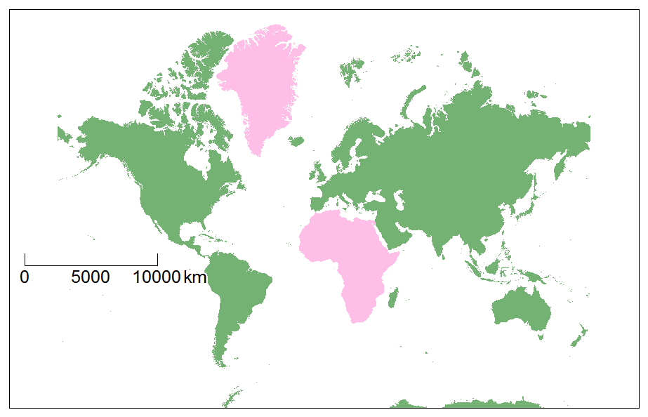
Actually, they’re not of the same size:
- Africa: 30 221 532 km²
- Greenland: 2 166 086 km²
So Africa is 14 times bigger than Greenland!
As said, distances are also not preserved. The lines pictured on the following map seem to be the same size but are in reality 2000 km long near the Equator and 345 km near the Pole:
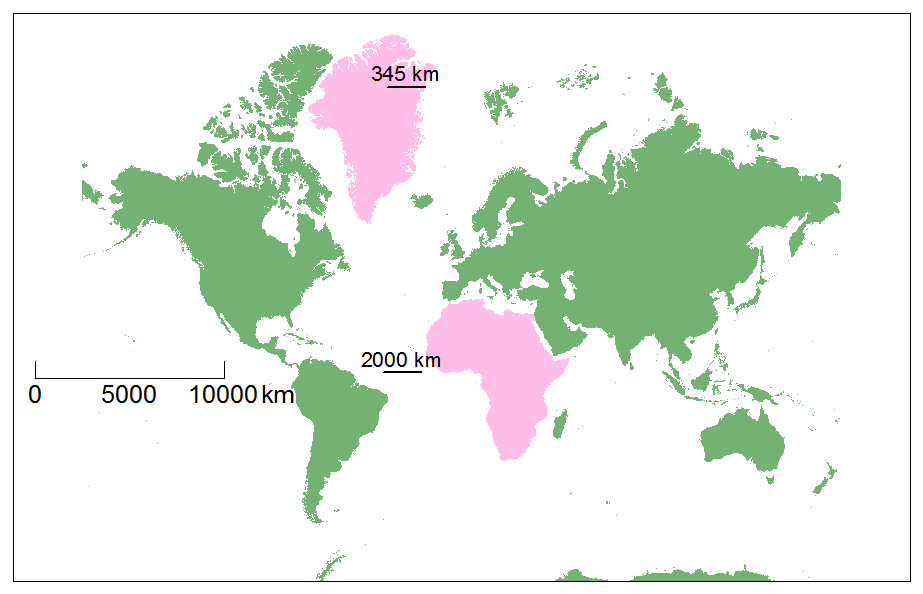
On Earth, the longitudes narrow as approaching the poles. On the Mercator map however, the “widths” of the longitudes stay the same, that causes the distances to stretch in some ways, and consequently to appear larger at the Poles.
Let’s take another presentation to better understand why the previous curved route is the shortest. Take Google Earth for instance, which has as 3D background:
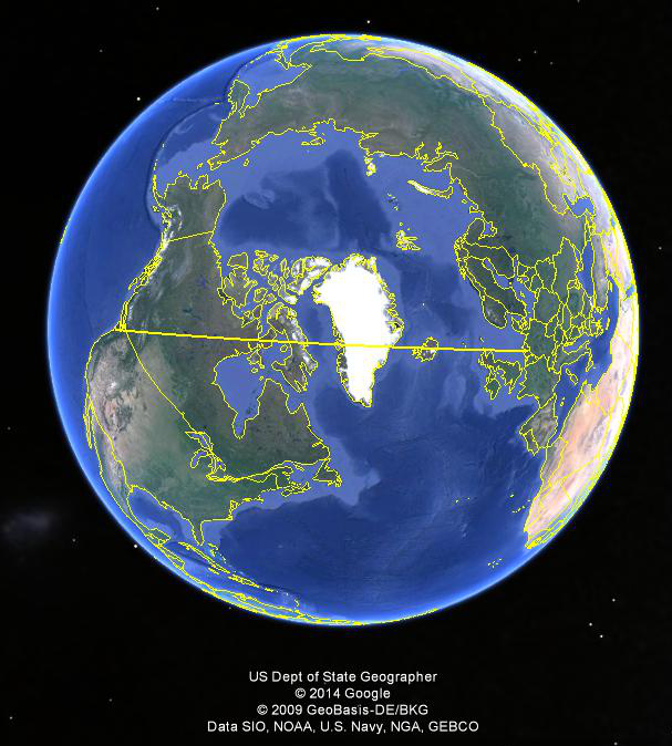
Seen from space, the shortest route looks more obvious. Straight lines are the shortest route on, for example, a gnomonic map projection:
Actually, the shortest route on Earth is a part of a great circle. A Great Circle is the intersection of a sphere and a plane going through the center of the circle. The shortest route is also called geodesic or orthodrome (here it is A-B):

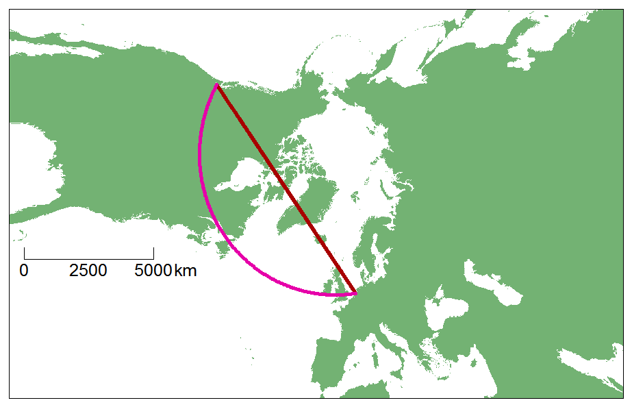
The Mercator map has this characteristic to preserve shapes and all the straight lines are in fact rhumb lines (also called loxodromes). A rhumb line is a line which bearing direction stays the same all along it. In other words, when flying from Amsterdam to Seattle by following a rhumb line, the pilot fixes a bearing direction and never changes it. The shortest route, in opposition, needs a permanent change in the bearing direction:

Here are the length for the shortest route and the rhumb line
- Shortest route: 7865 km
- Rhumb line: 9140 km
- Difference: 1275 km
Here are other example to illustrate the concept of shortest route VS loxodromes
London – Seoul:
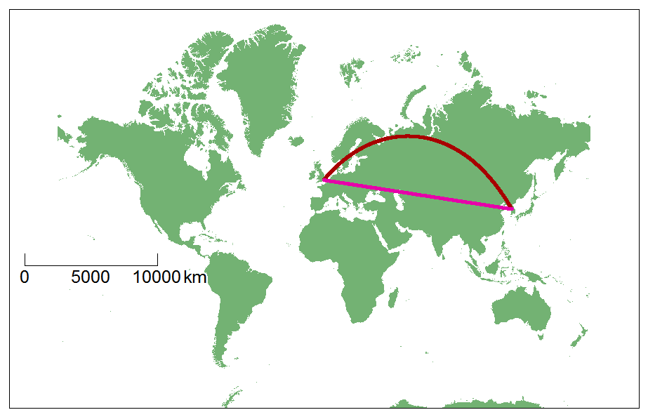
- Shortest route: 8890 km
- Rhumb line: 10161 km
- Difference: 1271 km
Notice that a plane flying from London to Seoul MUST NOT enter the North Korean airspace. So the final part of the journey will present a workaround.
Sydney – Santiago
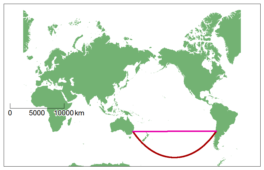
- Shortest route: 11 363 km
- Rhumb line: 12 802 km
- Difference: 1439 km
London – Sydney (notice how the bearing direction is first to North before taking the South direction)
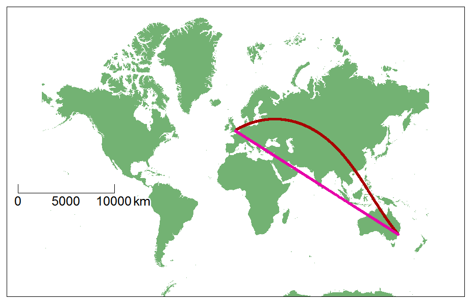
- Shortest route: 16 921 km
- Rhumb line: 17 708 km
- Difference: 787 km
Notice that planes does not radically take the shortest route from origin to destination. Other parameters come also into account such as the global wind directions, like the jet stream, airspace usage restrictions (eg: North Korea), etc.
Leave a Reply