
Belgium, small country in Western Europe, shares its borders with The Netherlands, Germany, Luxembourg and France. The length of the border with Germany has been reported to be 167km long …
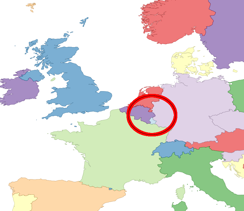
… but at a closer look, the border between both countries seems to be shorter than that.
How is it possible ?
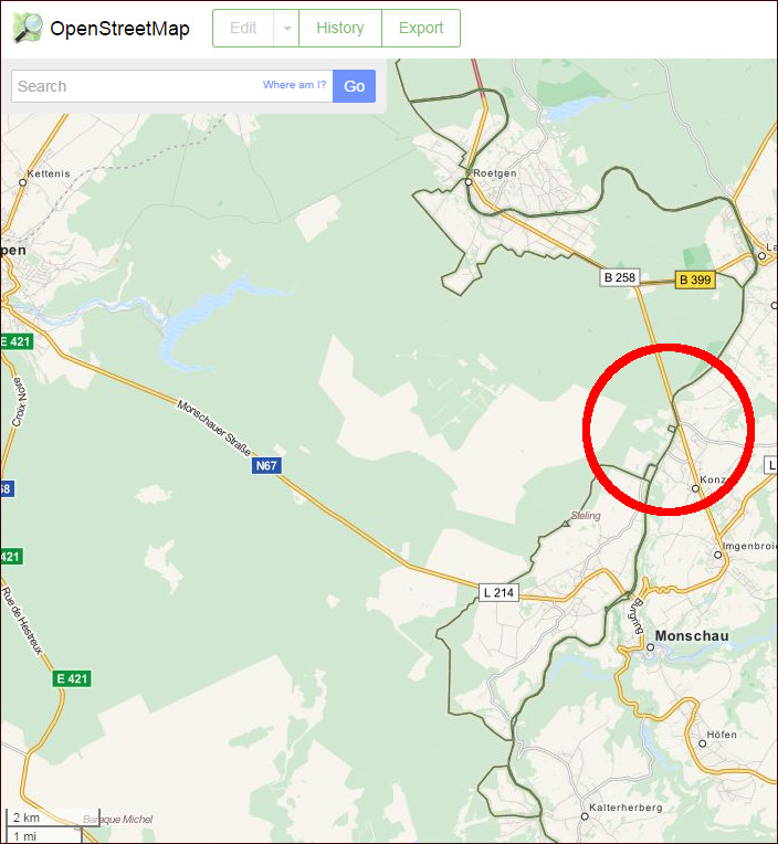
The border is not just a simple line as it seems. When checked on OpenStreetMap, we see a strange behavior.
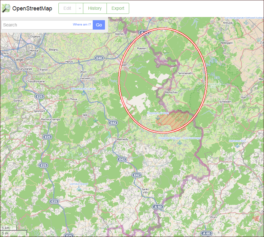
Like biologist with their microscopes, let’s zoom further to see what is really going on here (and let’s change the basemap to MapQuest Open to make the political boundaries more obvious):
That’s correct! There are German Exclaves! 5 to be exact (from North to South):
- Münsterbildchen 1.826 km²
- Roetgener Wald 9.98 km²
- Rückschlag 0.016 km²
- Mützenich 12.117 km²
- Ruitzhof 0.937 km²
Seriously, why are these pieces of Germany inside Belgium exclaves? And why are there two borders?
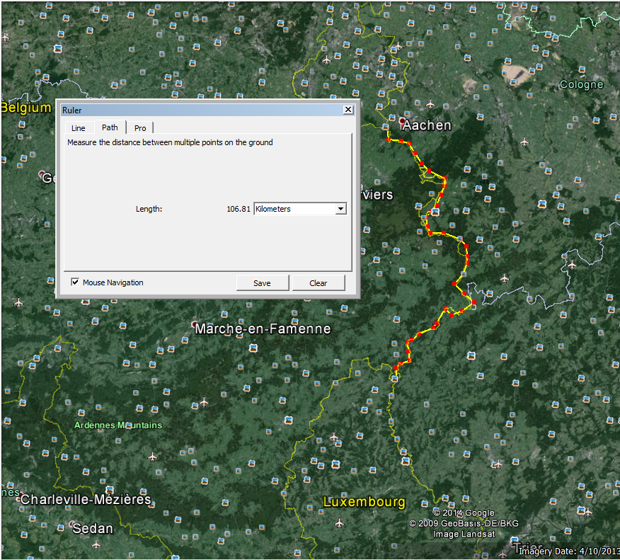
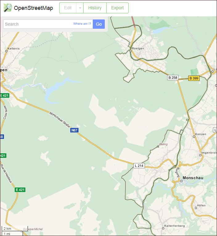
Let’s zoom more and more inside (using Google Maps):
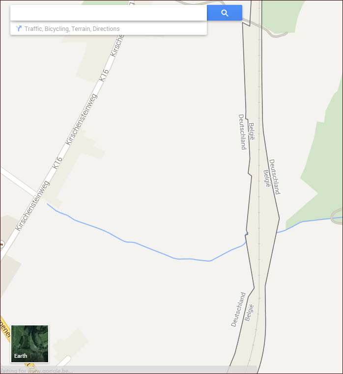
Oh, that’s really weird! There is “something” that causes a line with buffer around it to be “Belgium” inside of “Germany”. The “somewhat” is actually the track bed of a former operational train line that belongs to Belgium and has been kept by Belgium after World War I.
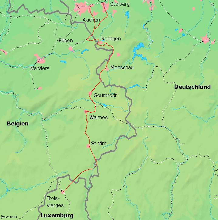
How this comes is a long story. The train line is the Vennbahn and was constructed by the in the Prussian State Railways in the then belonging to Prussia territories in 1885. The line went roughly from Troisvierges (LUX) to St Vith (BE) – Waimes (BE) – Sourbrodt (BE) – Monschau (DE) – Roetgen (DE) – Raeren (BE) – Eupen (BE) all the way through the High Fens (thus the name “Vennbahn”).
After WW I, there were some territorial changes in the area with the Treaty of Versailles. Without going into too much details, some German belonging lands went to Belgium and they were later called the East Cantons. People there still speak German and belong to the German Speaking Community of Belgium, but this is another story. At the treaty of Versailles, Belgium also claimed the track bed of the train line Vennbahn because of the usefulness of the train to transport iron and coal. Belgium got the GO from the assembly and became owner of the the track line of a few meters on each side of the railroad and thus, German exclaves were born.
Borders changed a little bit after WWII but the borders between Belgium and Germany were finally fixed in 1956.
Conclusion
The border between Belgium and Germany has to take into account the length of the border near the German exclaves. And thus, the roughly measured length of 106km on Google Earth is complety false compared to the real 167km. History explains why we have this strange border between both countries.
Bonus: Visit of the tiniest German exclave
The tiniest German Exclave is Rückschlag. It is as small as 1,5ha and is located here:
With a bigger zoom it looks like this:
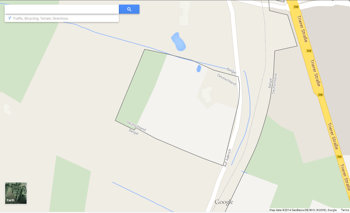
… and there’s of course a house in this little piece of Germany.
Here’s the slideshow of my trip to the exclave (created with http://flickrit.com/).
Nice little explanation of what seems to me to be a geo-political anomaly. I’m a big fan of Belgian beer (and many other things Belgian… never lived there, however; have lived in Switzerland and Italy as well as Canada and the States).
Just trying to figure out if there was a river along the border to explain its funky shape.
You’re welcome Chris! Have you been to Belgium yet?