The Copernicus’s Sentinel-2 programme makes it possible to have a full mosaic coverage of any point in Europe with a revisit of 5 days at the Equator, provided no clouds come to ruin the party. The resolution of 10 m for the visible bands 2, 3 and 4 are also very interesting making it possible to spot quite reasonable details.
In this article, I created a mosaic with the most recent individual cloud-free Sentinel-2 granules covering Belgium. That means, the timestamp is different depending on the region you look. For the full workflow I’ve done creating this mosaic, please see here at the bottom of the article.
The full cloud-free Sentinel-2 mosaic of Belgium is of course free, please just ask and I will give you and I will provide it to you 🙂
As you notice, each of the granule were not properly color-balanced. It seems our Belgium is divide in two as a seam is clearly visible. Unfortunately, I did not find any way for a perfect color-balance in this area.
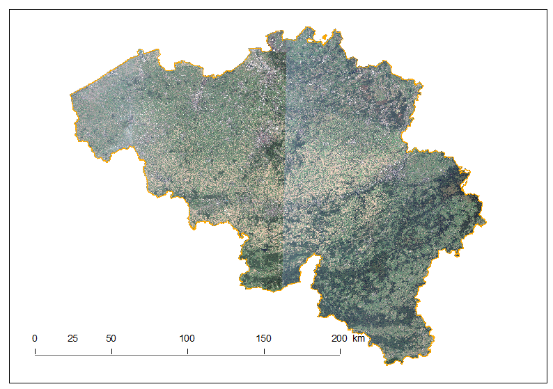
Let us discover Belgium using this mosaic.
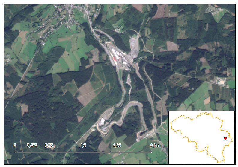
Our first stop is in the East of Belgium, with the Spa-Francorchamps Formula-1 track every fan knows about. Also known as the most beautiful circuit in the world, the track is 7 km long – the longest of the F1 season – and is located in the village of Francorchamps (which is part of the municipality of Stavelot and not Spa despite its name). We recognize, in the middle, the paddocks and the curve of La Source, just before the Eau rouge. The curve of Les Combes and Stavelot are respectively in the South East and West. If you past by, do not miss a walk in the beautiful surrounding Ardennes Region.
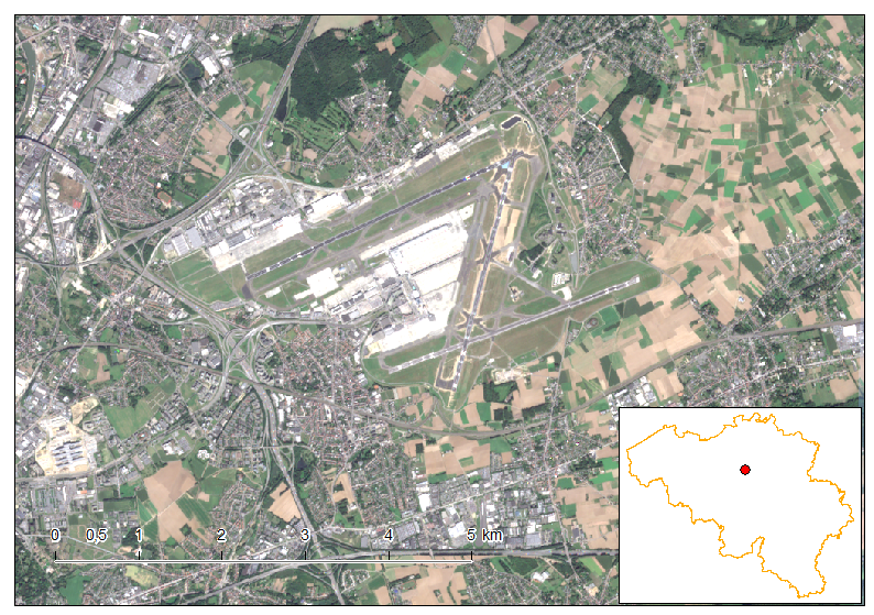
The second stop is Brussels-Airport, the center of March 2016 terrorist attacks. Depiste being called “Brussels-Airport”, tarmac and infrastructures are all located in the Flemish Region, just in the North-East of the Brussels Region. The three runways are clearly visible as well as all the surrounding houses. Urbanisation is very dense near the airport, which causes a lot of political frictions in the country.
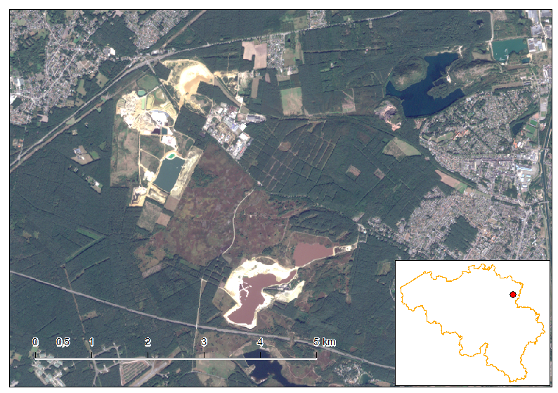
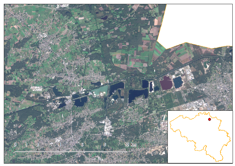
Our next stop is in the Hoge Kempen National park, the only one national park in Flanders. Covereing a total of 60 km², A lot of extraction activities did occur in this region and now it has become a tourist attraction for the beauty of the nature recovery. The waterbody in the South centre seems purple, unlike all the other waterbodies. Taking pictures from space is not like taking a picture on Earth. The atmosphere layer to cross is much more thicker and the wavelengths most altered are in the blue area. It is hence difficult to recover perfectly the colors, so here is the case as well.
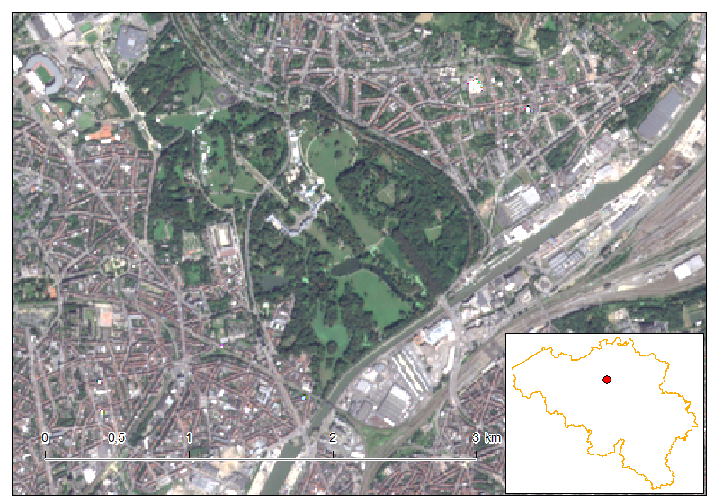
The King’s residence palace in Laeken, just 5 km from the Brussels’s city center. A beautiful park as big as 6 km² has numerous waterbodies, tennis courts and, most importantly, hosts the “Serres Royales”. It is an important collection of plants and flowers and is open to the public only during 3 weeks per year. Really worth it when you are in the area during the Easter period!
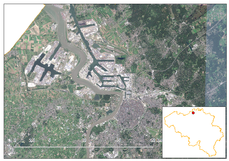
The city of Antwerp hosts the biggest maritime port of the country, and the third biggest maritime port in Europe after Rotterdam (NL) and Hamburg (DE). The cities lies at the mouth of the River Scheldt Worth telling is that the city is ranked number one in diamond trade. 80% of all the diamonds in the world transits through Antwerp. An important tourist attraction is the Antwerp zoo, founded in 1843, and is the oldest zoo on Earth.
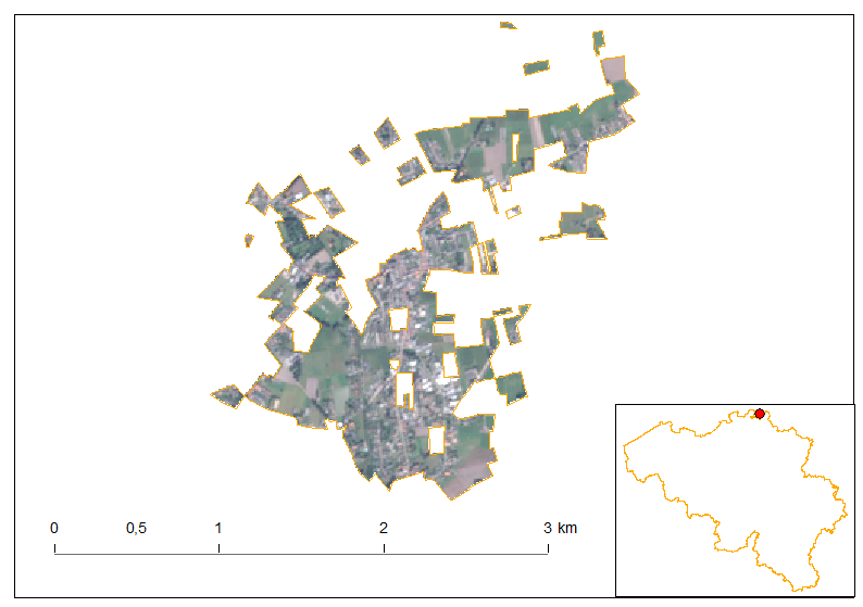
This fragmented area is no other than the municipality of Baarle-Hertog. The overall Belgian exclave has “holes” which are part of The Netherlands. This administrative anomaly comes for the period where borders have been drawn between the freshly born Belgium and The Netherlands. Representative were quite in accord with the separation line between both countries except in this area particular area. A lot of Belgian and Dutch owner were living there next to another. Archives have to be retrieved and documents dating up to the 1100’s were used to defined the border. Now beeing a tourist place where you can sit on a terrace in Belgium while ordering in the Netherlands.
The several bassins we’re seeing here is a sign of industrial activities. Most of the waterbodies are not used anymore and were transformed into recreative facilities. Lots of campings and holiday villages are located around some of the waterbodies. Paradoxally, the town of Dessel just in the North West of the view here hosts several nuclear facilities.
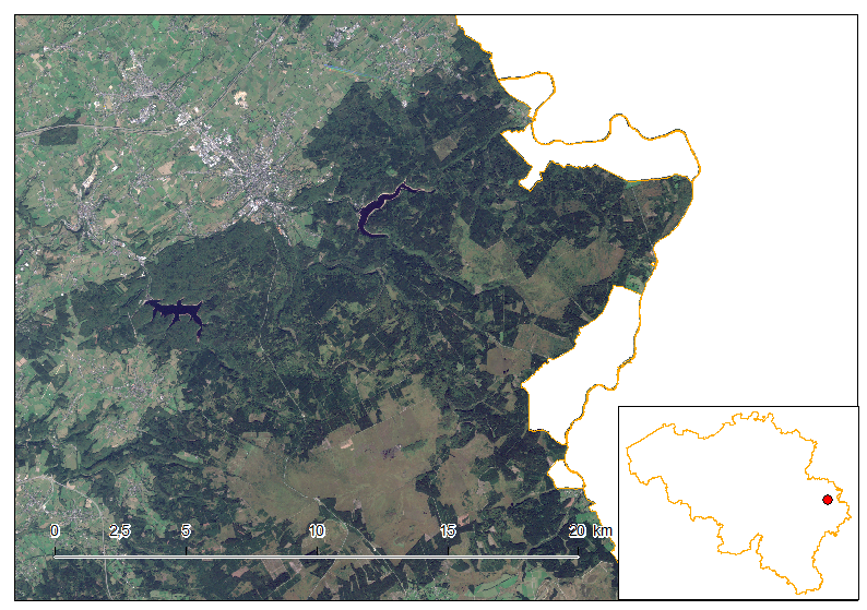
Another administrative border anomality lies in the Eastern part of Belgium. There are small corridors of Belgian land in Germany. How come? Discover it here. This part of Belgium is also where the highest point above the sea level lies: Signal de Botrange at 694m above Sea level. A lot of green areas are visible as the region is very densily forested. The two water bodies in the North of the image area, in the West, the barrage of the Gilpesse, and, in the East, the Barrage of Eupen.
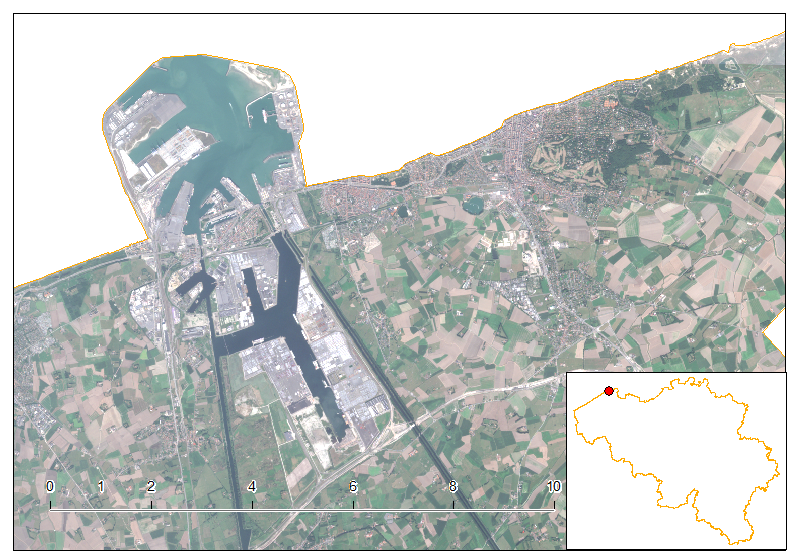
Another big miritime port in Belgium is the port of Zeebrugge. The portuar infrastruture extends ways beyond the coast (up to 3.5km into the North Sea). In the North East there is the chic coastal village of Knokke-Heist, known for being the Belgian’s St Tropez.
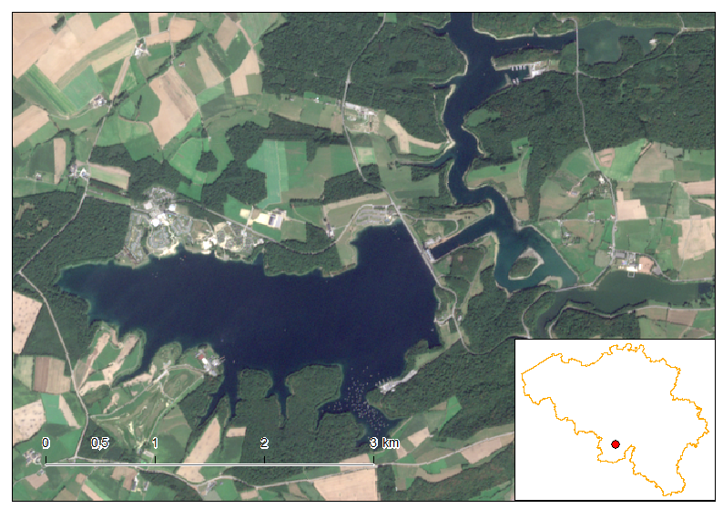
The lakes of l’Eau d’Heure is composed of 5 artifial waterbodies, which stretches over 600ha. This place is known for the watersports and fishing facilities. It is located at the South of the Province of Hainaut, but also partly in the Province of Namur.
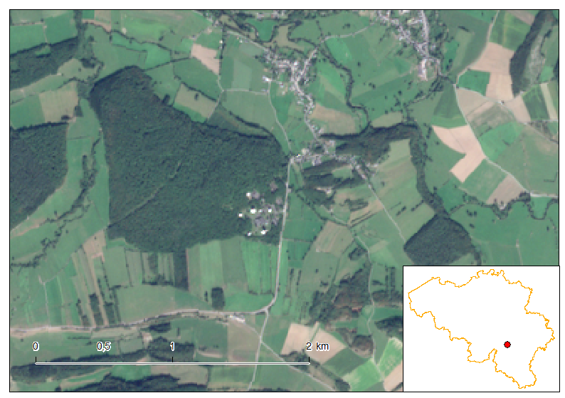
Belgium has an important space industry since decades. The area pictured here is a field of parabolic antenna which mission is to make the link between terrestrial and space communications. The village just above the antenna field is Lessive and not so far away lies the Euro Space Center, a business area deploying top notch space-related companies.
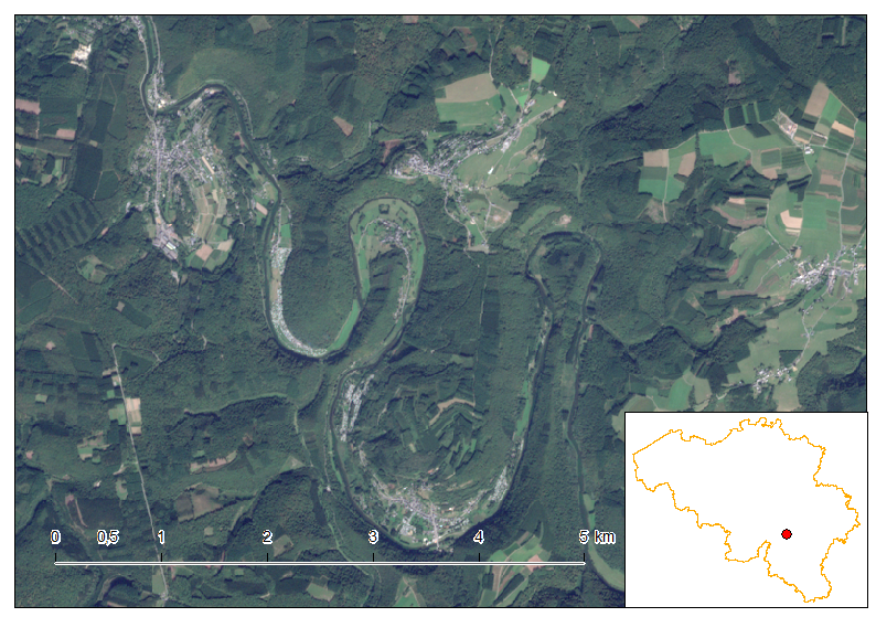
The Semois river flows not far away from the Belgian-French border. The numerous curves translate the rock and soil composition, mainly schist, as the river cuts its bed in the direction of the sheet-shaped underlying rock structure. Numerous idyllic villages are located in, or nearby, the Semois course and the most notable is Bouillon just a few kilometers from here.
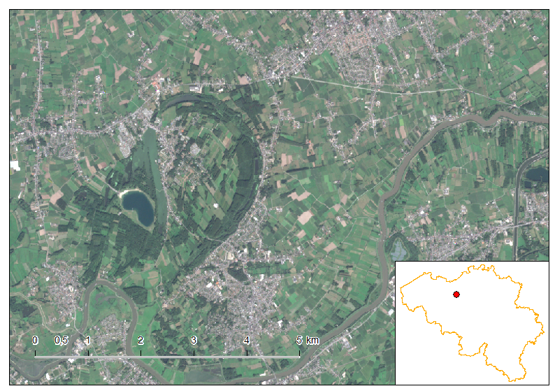
An abandoned meander, forming here an oxbow lake, is visible here near the town of Dendermonde. The river is the Scheldt, the same as the one that flows into the sea in Antwerp.
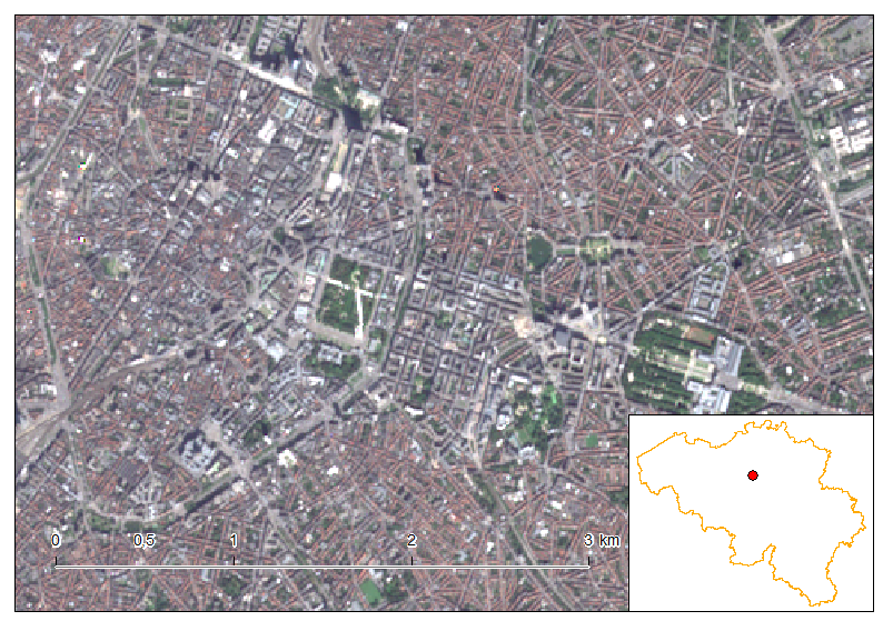
The journey accross Belgium would have been complete without a space view of Brussels, the capital of Belgium and home of most of the European Union institutions. Downtown is located in the West inside of the pentagon shaped road network. The European institutions are more in the center and in the East, near the parc du centenaire. Brussels is one of the capital in the worl where there are the most green spaces.
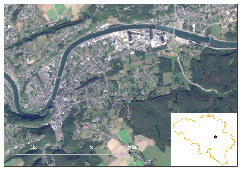
Belgium developped in the 70’s nuclear energy provisions, with the construction of the nuclear power plant of Tihange here, and another one in Doel, near Antwerp. The chemneys are visible in the North where only one is producing clouds. Tihange is very near to the town of Huy, which is in the West inside the curve of the Meuse River.
Belgium has much more to offer than just these 15 places described here. The article would have been far too long if all the beautiful places would have been described.
I hope you enjoyed this small Sentinel-2 journey accorss Belgium and I hope the images of Belgium is much more brighter to you than just reduced to Belgian (!) Fries and chocolate eaters.
Cheers,
Daniel
Full recipe to reproduce at home
Full recipe to reproduce at home, provided you have a valid ArcGIS for Desktop license.
I am used to use python scripting as much as I can. This gives me more control of the geoprocessing rather than using a UI.
For this mosaic, I used the following granules (see this article to get the granules):
31UDS_20160921
31UFS_20160925
31UER_20160908
31UES_20160908
31UET_20160401
31UFQ_20160826
31UFR_20160925
31UGS_20160925
31UFT_20160925
31UGR_20160925
First, we go through a set of imports of the original Sentinel-2 jp2 images into the gdb format. Repeat this procedure 9 times for each of the granules.
import arcpy
arcpy.RasterToGeodatabase_conversion(['<PATH_TO_DATA>\\IMG_DATA\\B01.jp2',
'<PATH_TO_DATA>\\IMG_DATA\\B02.jp2', '<PATH_TO_DATA>\\IMG_DATA\\B03.jp2',
'<PATH_TO_DATA>\\IMG_DATA\\B04.jp2', '<PATH_TO_DATA>\\IMG_DATA\\B05.jp2',
'<PATH_TO_DATA>\\IMG_DATA\\B06.jp2', '<PATH_TO_DATA>\\IMG_DATA\\B07.jp2',
'<PATH_TO_DATA>\\IMG_DATA\\B08.jp2', '<PATH_TO_DATA>\\IMG_DATA\\B09.jp2',
'<PATH_TO_DATA>\\IMG_DATA\\B10.jp2', '<PATH_TO_DATA>\\IMG_DATA\\B11.jp2',
'<PATH_TO_DATA>\\IMG_DATA\\B12.jp2', '<PATH_TO_DATA>\\IMG_DATA\\B8A.jp2'], r'<PATH_TO_GDB>\WHOLE_BELGIUM.gdb')
arcpy.Rename_management(r'<PATH_TO_GDB>\WHOLE_BELGIUM.gdb\B01', 'B01_01')
arcpy.Rename_management(r'<PATH_TO_GDB>\WHOLE_BELGIUM.gdb\B02', 'B02_01')
arcpy.Rename_management(r'<PATH_TO_GDB>\WHOLE_BELGIUM.gdb\B03', 'B03_01')
arcpy.Rename_management(r'<PATH_TO_GDB>\WHOLE_BELGIUM.gdb\B04', 'B04_01')
arcpy.Rename_management(r'<PATH_TO_GDB>\WHOLE_BELGIUM.gdb\B05', 'B05_01')
arcpy.Rename_management(r'<PATH_TO_GDB>\WHOLE_BELGIUM.gdb\B06', 'B06_01')
arcpy.Rename_management(r'<PATH_TO_GDB>\WHOLE_BELGIUM.gdb\B07', 'B07_01')
arcpy.Rename_management(r'<PATH_TO_GDB>\WHOLE_BELGIUM.gdb\B08', 'B08_01')
arcpy.Rename_management(r'<PATH_TO_GDB>\WHOLE_BELGIUM.gdb\B09', 'B09_01')
arcpy.Rename_management(r'<PATH_TO_GDB>\WHOLE_BELGIUM.gdb\B10', 'B10_01')
arcpy.Rename_management(r'<PATH_TO_GDB>\WHOLE_BELGIUM.gdb\B11', 'B11_01')
arcpy.Rename_management(r'<PATH_TO_GDB>\WHOLE_BELGIUM.gdb\B12', 'B12_01')
arcpy.Rename_management(r'<PATH_TO_GDB>\WHOLE_BELGIUM.gdb\B8A', 'B8A_01')
Create then a distinct mosaic dataset for each of the bands. Here’s the example for Band n°1, and repeat the process for bands 2, 3 until 12 (do not forget band n°8A!).
arcpy.CreateMosaicDataset_management(in_workspace="<PATH_TO_GDB>/WHOLE_BELGIUM.gdb",
in_mosaicdataset_name="B01", coordinate_system="PROJCS['Belge_Lambert_2008',GEOGCS['GCS_ETRS_1989',DATUM['D_ETRS_1989',
SPHEROID['GRS_1980',6378137.0,298.257222101]],PRIMEM['Greenwich',0.0],UNIT['Degree',0.0174532925199433]],
PROJECTION['Lambert_Conformal_Conic'],PARAMETER['False_Easting',649328.0],PARAMETER['False_Northing',665262.0],
PARAMETER['Central_Meridian',4.359215833333333],PARAMETER['Standard_Parallel_1',49.83333333333334],
PARAMETER['Standard_Parallel_2',51.16666666666666],PARAMETER['Latitude_Of_Origin',50.797815],
UNIT['Meter',1.0]];-35373000 -30122500 10000;-100000 10000;-100000 10000;0,001;0,001;0,001;IsHighPrecision",
num_bands="", pixel_type="", product_definition="NONE", product_band_definitions="")
Add then the bands to the mosaic. (to do for all the layers)
arcpy.AddRastersToMosaicDataset_management(in_mosaic_dataset="<PATH_TO_GDB>/WHOLE_BELGIUM.gdb/B01",
raster_type="Raster Dataset", input_path="<PATH_TO_GDB>\\WHOLE_BELGIUM.gdb\\B01_01;
<PATH_TO_GDB>\\WHOLE_BELGIUM.gdb\\B01_02;
<PATH_TO_GDB>\\WHOLE_BELGIUM.gdb\\B01_03;
<PATH_TO_GDB>\\WHOLE_BELGIUM.gdb\\B01_04;
<PATH_TO_GDB>\\WHOLE_BELGIUM.gdb\\B01_05;
<PATH_TO_GDB>\\WHOLE_BELGIUM.gdb\\B01_06;
<PATH_TO_GDB>\\WHOLE_BELGIUM.gdb\\B01_07;
<PATH_TO_GDB>\\WHOLE_BELGIUM.gdb\\B01_08;
<PATH_TO_GDB>\\WHOLE_BELGIUM.gdb\\B01_09;
<PATH_TO_GDB>\\WHOLE_BELGIUM.gdb\\B01_10;
",update_cellsize_ranges="UPDATE_CELL_SIZES", update_boundary="UPDATE_BOUNDARY",
update_overviews="NO_OVERVIEWS", maximum_pyramid_levels="", maximum_cell_size="0",
minimum_dimension="1500", spatial_reference="", filter="#", sub_folder="SUBFOLDERS",
duplicate_items_action="ALLOW_DUPLICATES", build_pyramids="NO_PYRAMIDS", calculate_statistics="NO_STATISTICS",
build_thumbnails="NO_THUMBNAILS", operation_description="#", force_spatial_reference="NO_FORCE_SPATIAL_REFERENCE")
The mosaic are then exported to raster dataset into a gdb (do it for all of the mosaic/bands).
arcpy.MosaicToNewRaster_management(input_rasters="<PATH_TO_GDB>/WHOLE_BELGIUM.gdb/B01",
output_location="<PATH_TO_GDB>/WHOLE_BELGIUM.gdb", raster_dataset_name_with_extension="BELGIUM_B01",
coordinate_system_for_the_raster="", pixel_type="16_BIT_UNSIGNED", cellsize="",
number_of_bands="1", mosaic_method="LAST", mosaic_colormap_mode="FIRST")
Finally we have to clip the final results to only keep pixels inside the Belgium territory (for that, we need a Belgium layer with the exact national extent).
arcpy.Clip_management(in_raster="<PATH_TO_GDB>/WHOLE_BELGIUM.gdb/BELGIUM_B01",
rectangle="522281,353430353 521165,124731085 795172,027834512 744030,366077007",
out_raster="<PATH_TO_GDB>/WHOLE_BELGIUM.gdb/BELGIUM_B01_Clip",
in_template_dataset="<PATH_TO_GDB>/WHOLE_BELGIUM.gdb/BELGIUM", nodata_value="65536",
clipping_geometry="ClippingGeometry", maintain_clipping_extent="NO_MAINTAIN_EXTENT")

Good job. You say “For this mosaic, I used the following granules (see this article to get the granules):” but there is no link to such an article. Could you please post the link to the article for how to get the granules?
Best regards,
John
Hi John! Thanks for your comment!
The way you can get the data is described here http://themagiscian.com/2016/09/01/agriculture-unsupervised-classification/
Very easy you will see 🙂
Best Regards,
Daniel
Thanks!